One of the reasons given for the naming of the Boroughs was because it was a maze of interconnecting streets much like rabbit burrows

Fort Street was a cul-de-sac off Bristol Street

Bristol Street ran uphill from Bath Street to meet Little Cross Street, Castle Street, Castle Terrace and Fitzroy Street

St Mary’s Street ran from Horsemarket to Doddridge Street. The view here is east towards Horsemarket with St Katherine’s Church in the background

Bath Street on a winter’s day in 1959 looking uphill from Little and Lower Cross Street towards the Mayorhold; this is one of the only tree-lined streets in the Boroughs

Bath Street had its share of corner shops essential for the residents of the Boroughs who often purchase goods “on the slate”

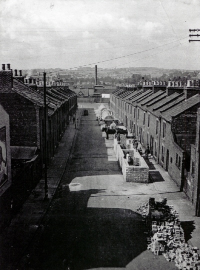
Herbert Street joined Crispin Street directly opposite Spring Lane School, here with air raid shelters under construction (1939)

This view of the north part of the Boroughs gives an excellent impression of the built-up nature of the area. In the foreground is Cooper Street with its characteristic “dog-leg” bend. To the right, St Andrew’s Church survives into the 1960s and opposite the church are the art deco 1930s flats in Bell Barn Street. These flats can be seen better in the picture below

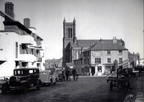
Below, an evocative view of the pre-war Boroughs; it brings back an age with few cars and a slower pace of life. The “modern” flats in Bell Barn Street are very clear here with their balconies and smooth white surfaces. “C H Masters” store provides the local people with a wide range of goods.
© Copyright : Graham Ward. All rights reserved.